The Lake George 12ster Hiking Challenge: Hike 12 Peaks in the Southern Adirondacks
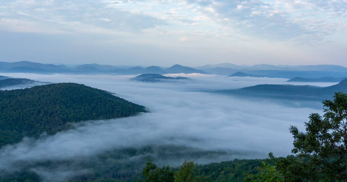
![]() Although the 46 High Peaks of the Adirondacks are the main attraction for hikers, the Southern Adirondacks should not be disregarded. There are plenty of fun and challenging peaks in this area, particularly around the Lake George region.
Although the 46 High Peaks of the Adirondacks are the main attraction for hikers, the Southern Adirondacks should not be disregarded. There are plenty of fun and challenging peaks in this area, particularly around the Lake George region.
If you're looking for a new challenge that isn't as grueling as the 46er but is harder than the 6er, then the Lake George 12ster is the one for you.
Brief History of the Lake George 12ster
The Lake George 12ster hiking challenge was created by Matthew Haley in the summer of 2016. While preparing for endurance trail races, Haley was surprised to discover how many peaks and trails in the Lake George area he had never heard about. For him, these hidden gems in the Southern Adirondacks deserved more attention. After Haley was introduced to the Saranac Lake 6er ultra hiking challenge, he decided to create his own - the Lake George 12ster.
Here Are the Rules of the Challenge
The Lake George 12ster challenges hikers to climb the specified 12 peaks in the Lake George region, which amounts to roughly 40 miles of trails and 9,000 feet of elevation gain. The peaks can be hiked in any order. Once complete, a hiker must fill out the proper registration form and submit it with a small $10 fee to receive a certificate, a 12ster number, and a patch.
Regular 12ster Challenge: Summit all 12 of the challenge's peaks on or after August 20th, 2016. There is no deadline, but once you complete the challenge, you must register to become an official Lake George 12ster.
Ultra 12ster Challenge: Complete the entire challenge within a 24-hour period. You must label your first sign-in and final sign-out at the trail registers as "Ultra 12ster." Include your finish time on the final trail register as well. In addition, provide evidence (photos, GPS, or write-up of the day).
Winter 12ster Challenge: Summit all 12 peaks between December 21 through March 21.
Winter Ultra 12ster Challenge: A combination of the Ultra 12ster and the Winter 12ster challenges.
The 12 Peaks
There are 12 peaks you must summit as part of the Lake George 12ster challenge. Some are located on the east side of Lake George, and others are on the west side.
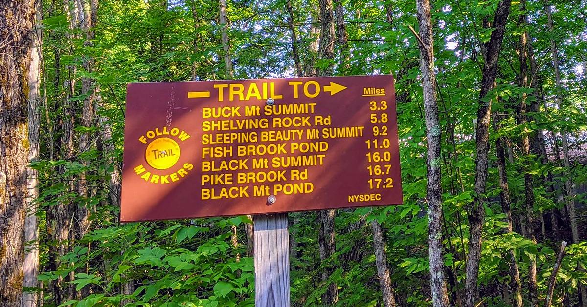
1. Black Mountain: Black Mountain is located on the eastern shore of Lake George just south of Huletts Landing. The mountain has an elevation of 2665 feet, and it is considered a relatively easy hike with some challenging sections. The trail is 2.5 miles in length.
Access: Park at 1281 Pike Brook Road, Clemons, NY. The trailhead is close by.
2. Buck Mountain: Buck Mountain is located on the eastern shore of Lake George by Pilot Knob. The 3-mile long trail is slightly rocky and not ideal for younger children. However, the view from the top is worth the effort of taking on this moderate 3.3-mile long hike.
Access: The trailhead is located at 1750 Pilot Knob Road, Kattskill Bay, NY. A parking lot is available at the site.
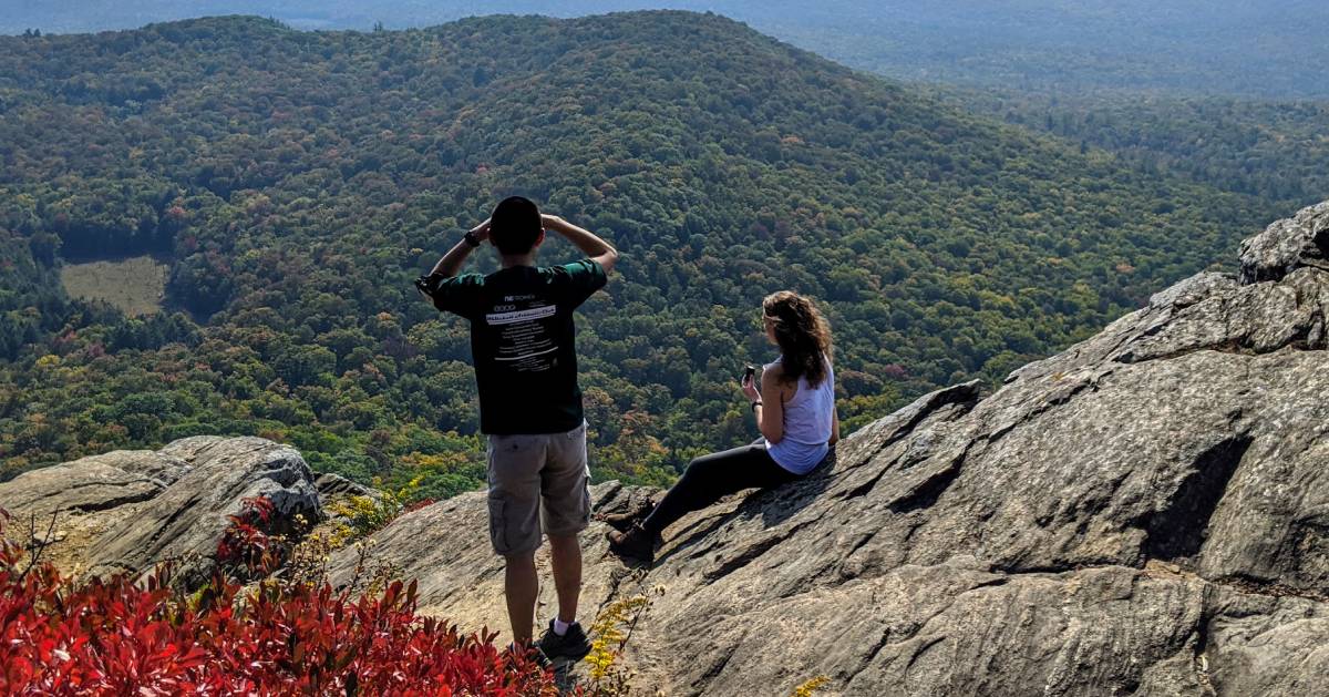
 View from Cat Mountain summit, photo credit: @kehanselman
3. Cat Mountain: This hiking trail is roughly 3 miles in length is features a few challenging spots. A side trail leads to the neighboring Thomas Mountain.
Access: Drive to 761 Valley Woods Road, Bolton Landing, NY and there will be a gravel parking area nearby at the trailhead.
4. Thomas Mountain: The trailhead for Thomas Mountain is the same for Cat Mountain. Thomas Mountain is the shorter trail of the two at 1.4 miles in length. This is an old logging trail with good footing.
Access: Drive to 761 Valley Woods Road, Bolton Landing, NY and there will be a gravel parking area nearby at the trailhead.
5. Erebus Mountain: This is one of the more challenging peaks because of how it's accessed. The main trailhead is at Dacy Clearing, which is also the trailhead for Sleeping Beauty Mountain. You must hike 3 miles from Dacy Clearing to Fishbrook Pond. The Lake George 12ster website states an official trail does not exist for Erebus Mountain, so all you have to do is cross the dotted line, as seen on their map.
Access: Follow Shelving Rock Road in Fort Ann, NY to the Hogtown Trailhead, and then continue on Dacy Clearing Road to the main trailhead.
6. Sleeping Beauty Mountain: From the Dacy Clearing trailhead to the summit of Sleeping Beauty Mountain, the trail is roughly 2.5 miles in length. This hike is best for families with older children, and it is well-marked.
Access: Follow Shelving Rock Road in Fort Ann, NY to the Hogtown Trailhead, and then continue on Dacy Clearing Road to the main trailhead.
Tongue Range Notes:
All six of the following peaks are a part of the Tongue Mountain range on the west shore of Lake George.
In addition, mountains in the Tongue Range are a known habitat for Timber Rattlesnakes. They are the largest venomous snake in New York State, so you should be extra cautious while traversing this area. Learn more about Timber Rattlesnakes »
7. Brown Mountain (Tongue Range): This mountain is on the northern end of the Tongue Range. It is about 1.6 miles from the Deer Leap trailhead to the summit of Brown Mountain.
Access: To reach the Deer Leap trailhead, from Exit 24, take Bolton Landing-Riverbank Road. After 4.7 miles, head north on Route 9N. Follow the road for about 10 miles until you reach the parking area called Deer Leap on the right side.
8. Huckleberry Mountain (Tongue Range): For reference, Huckleberry Mountain is located between Brown Mountain and Five Mile Mountain in the Tongue Range. It can be reached from the Deer Leap trailhead.
Access: To reach the Deer Leap trailhead, from Exit 24, take Bolton Landing-Riverbank Road. After 4.7 miles, head north on Route 9N. Follow the road for about 10 miles until you reach the parking area called Deer Leap on the right side.
9. Five Mile Mountain (Tongue Range): If you continue south from Brown Mountain, you'll reach Five Mile Mountain. It is about two miles south of Brown Mountain, and the suggested access point is also from the Deer Leap trailhead.
Access: To reach the Deer Leap trailhead, from Exit 24, take Bolton Landing-Riverbank Road. After 4.7 miles, head north on Route 9N. Follow the road for about 10 miles until you reach the parking area called Deer Leap on the right side.
10. Fifth Peak (Tongue Range): This mountain is about 2.5 miles in length from the Clay Meadow trailhead. The trail is fairly easy to traverse.
Access: To reach the Clay Meadows trailhead, from Exit 24, take Bolton Landing-Riverbank Road. After 4.7 miles, head north on Route 9N. Follow the road for 4.5 miles until you reach the parking area called Clay Meadows on the right side. The trailhead is just down the road with a DEC sign.
11. French Point Mountain (Tongue Range): The summit of French Point Mountain is about two miles south from Fifth Peak. However, the terrain between the two is rugged.
Access: To reach the Clay Meadows trailhead, from Exit 24, take Bolton Landing-Riverbank Road. After 4.7 miles, head north on Route 9N. Follow the road for 4.5 miles until you reach the parking area called Clay Meadows on the right side. The trailhead is just down the road with a DEC sign.
12. First Peak (Tongue Range): First Peak is at the southern end of the Tongue Range, and the summit is about 1.4 miles from French Point Mountain.
Access: To reach the Clay Meadows trailhead, from Exit 24, take Bolton Landing-Riverbank Road. After 4.7 miles, head north on Route 9N. Follow the road for 4.5 miles until you reach the parking area called Clay Meadows on the right side. The trailhead is just down the road with a DEC sign.
Register at LakeGeorge12ster.com.