The Moriah Challenge: Four Family-Friendly Hikes
 For a fun hiking challenge that even beginners can complete, choose the Moriah Challenge in the Adirondacks! Centered around the Moriah area, this challenge consists of four hikes that both adults and kids with limited hiking experience can handle.
The Port Henry/Moriah Chamber of Commerce created the Moriah Challenge in collaboration with Champlain Area Trails in 2017.
Rules of the Moriah Challenge
If you finish all four hikes listed below as of May 1, 2017 and forward you can send in your info on dates the trails were hiked to retrieve the patch. The embroidered hiking patches can be obtained at the Moriah Chamber of Commerce office (4317 Main Street, Port Henry). Trail maps can be picked up at the office as well.
For more information, email moriahchamber@gmail.com or call 518-250-1050.
The Four Hikes
The Moriah Challenge's four hikes vary in length, but they are all family friendly and can be completed in a fairly short amount of time. You may complete the hikes in any order - just remember to write down the dates.
1. Belfry Mountain Trail
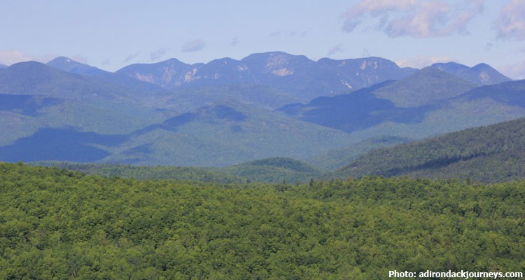
The Belfry Mountain Trail is a short and quick hike along a mostly gravel road that offers an amazing view of the High Peaks Region, the Champlain Valley, and more. Although the .35-mile long trail travels uphill, it is not very steep. Near the end, the trail becomes more of a foot path and leads to a fire tower.
Directions/Access: To reach the Belfry Mountain Trail, start in Witherbee and drive to the intersection of Tracy Road and Belfry Road. Take Belfry Road, and as it becomes Dalton Hill Road, look for a trailhead on the left and parking space on the right.
2. Big Hollow/Coot Hill Trail
Known as both Big Hollow and Coot Hill, this hiking trail can be tackled differently depending on where you start. If you choose to walk along an unmaintained portion of Lang Road in Port Henry, then the hike will be 1.5 miles long. If you choose to drive down Lang Road and park at an old cemetery, the hike will only be .35 miles long. Either way, the end of the trail will provide hikers with a stunning view of Big Hollow and the Champlain Valley.
Direction/Access: From Moriah, head south on Route 7/South Moriah Road until you see Big Hollow Road/Lang Road on the left. While the first part of the road is maintained, the rest is not, so you may want to park and walk to the old cemetery and the trail.
3. Cheney Mountain Trail
The Cheney Mountain Trail is a little over .8 miles long and located on land owned by the Town of Moriah. From the trailhead, the Cheney Mountain Trail will take you across a field before it travels through a forest along an old road. This road will steadily increase in elevation and bring you to a wooded summit. Take the trail a little farther, and you'll be rewarded with two great views of the area.
Directions/Access: North of Port Henry, follow Route 9N to the intersection with Route 54/Pilfershire Road. Drive down Pilfershire Road for about 2 miles until you see the trailhead on the left.
4. Crowfoot Pond Trail
At 6 miles long, the Crowfoot Pond Trail is mostly flat with just a slight gain in elevation. As you travel along the foot trail, you'll eventually walk past a pond and then reach private property on the north shore of Crowfoot Pond. This marks the end of the trail, but before you leave, be sure to take in the view of the surrounding wilderness.
Directions/Access: From Exit 30 on I-87, travel down Route 9 a short ways until you reach Tracy Road. Go down Tracy Road for 1.75 miles until you reach the trailhead on the right. Parking is available down a steep dirt entrance, so be aware of other drivers.
Sources:
- http://www.porthenrymoriah.com/