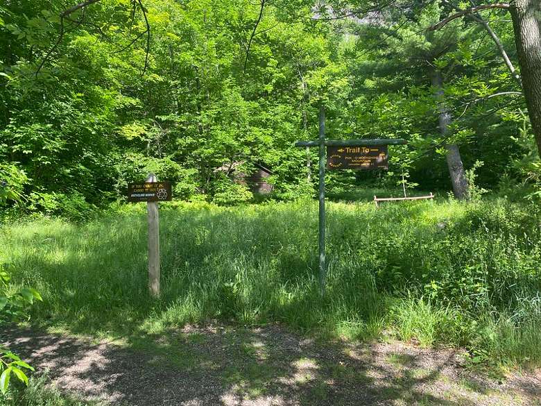
Looking to explore a fire tower hike in the beautiful Adirondack region? Just off the I-87 Northway is Poke-O-Moonshine Mountain! This historic trail is a 3.2 mile, moderate adventure that has incredible views from bottom to top!
Distance: 3.2 miles roundtrip
Elevation: 1,279 ft
Approximate time: 3 hours
Looking to explore a fire tower hike in the beautiful Adirondack region? Just off the I-87 Northway is Poke-O-Moonshine Mountain! This historic trail is a 3.2 mile, moderate adventure that has incredible views from bottom to top!
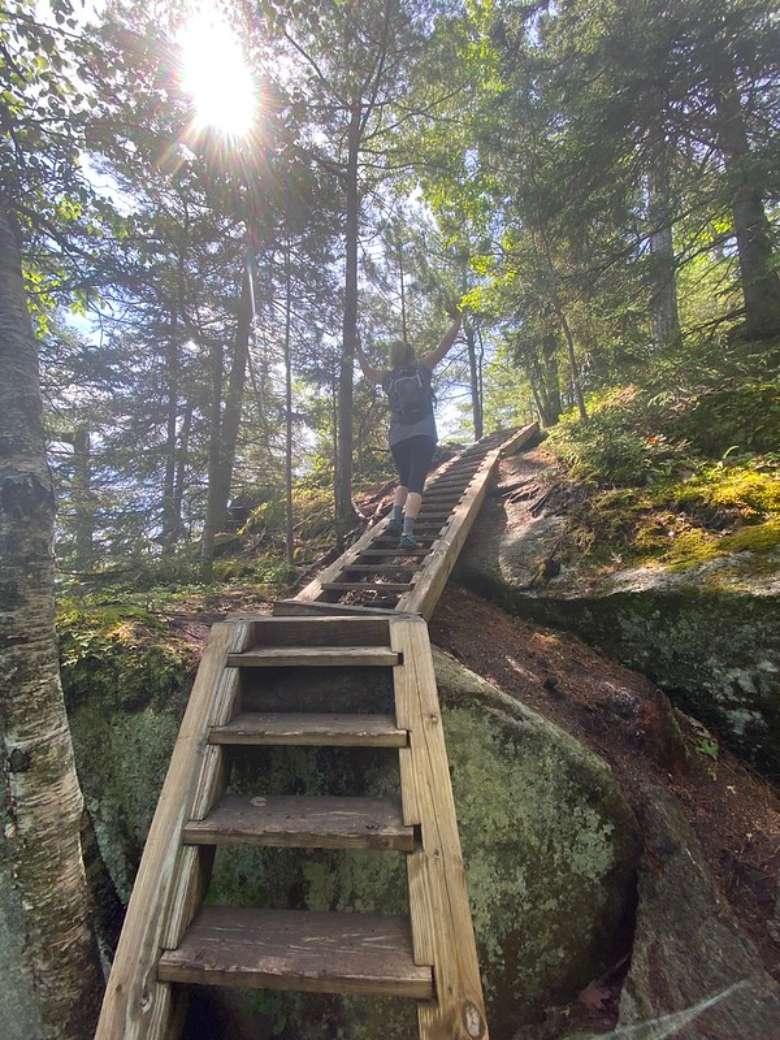
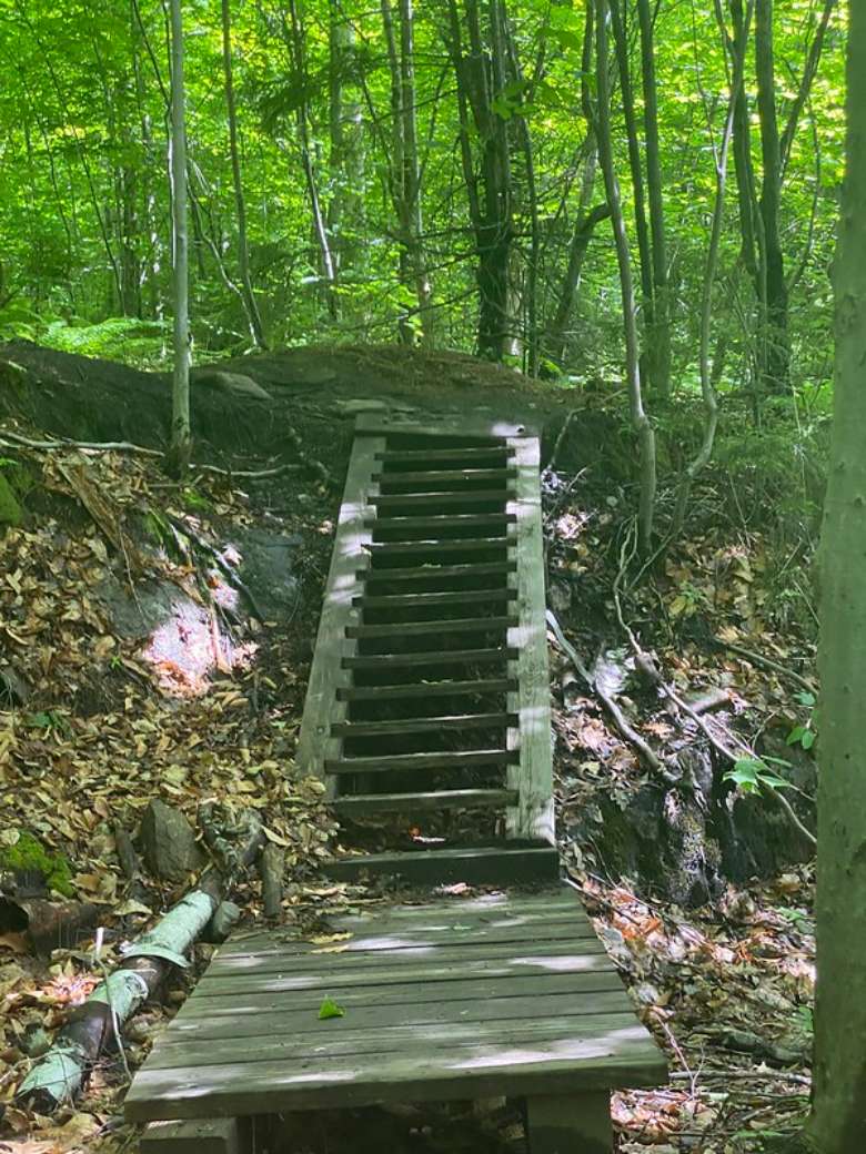
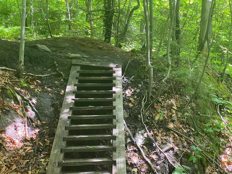
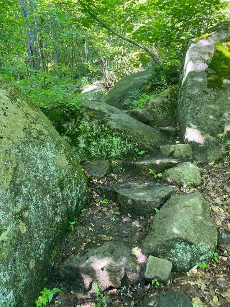
The distance of the Poke-O-Moonshine trail isn’t overly long, but this trek may still be a little challenging for some hikers. It is well kept and clearly marked, but is moderately steep and stair heavy. Updates were recently made due to erosion, and the trail is now more accessible to all hikers and four-legged friends should you choose to bring them along on this dog-friendly adventure!
If you’re interested in a hike that takes you back in time through the history of the Adirondack region, you’ve come to the right place! Not only does this hike have a unique and intriguing name, but it has a really interesting story to go along with it. There are multiple theories surrounding the naming of this historic trail. Some say this hike has taken on this name due to the opening or “poke” that was left between the trails' rock composure. At night time, this opening allows for the moon to shine within and light up the path. Another theory about this title is that it originated from Algonquin translations that describe that the rocks are smooth (moosi), and cracked (pohqui). Countless people have their own interpretation of what this name means, but at the end of the day, what matters most is why this hike means so much to people.
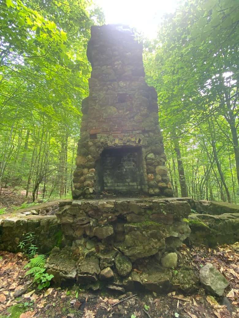
This hike has been known and loved for a very long time. In 1917, the fire tower at Poke-O-Moonshine was built in reaction to an increase in wildfires throughout the Adirondack region. For a good portion of the year, wildlife management observers would take the trek up the trail and call this mountain home. They would reside within a cabin and use the fire tower as an observational tool to keep track of potential fires in the surrounding area. As technological advancements were made towards the 1980s, having a person physically observe didn’t really seem necessary anymore. There were satellites, radios, and other useful ways to keep an eye out. This shift prompted environmental officers to express the possibility of closing the ranger trail and taking down the fire towers in the areas completely. But, many people came together to support the enhancement of this trail and tower, rather than the destruction. Volunteers partnered with DEC to rebuild safely and securely. Stone steps were put into the trail at a high price and great participation due to the love of the trail and the desire to preserve it for public use. Some say this trail and the beautiful stone that lines it, will last forever.
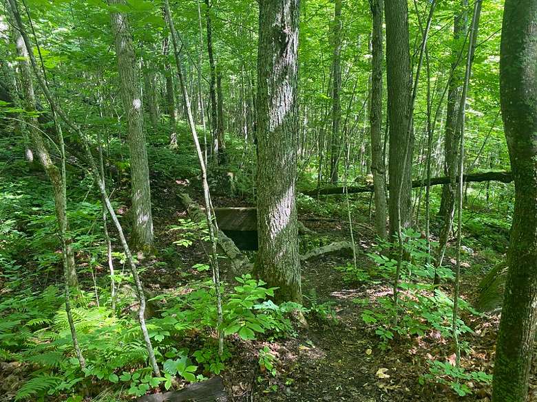
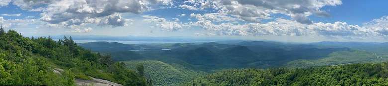
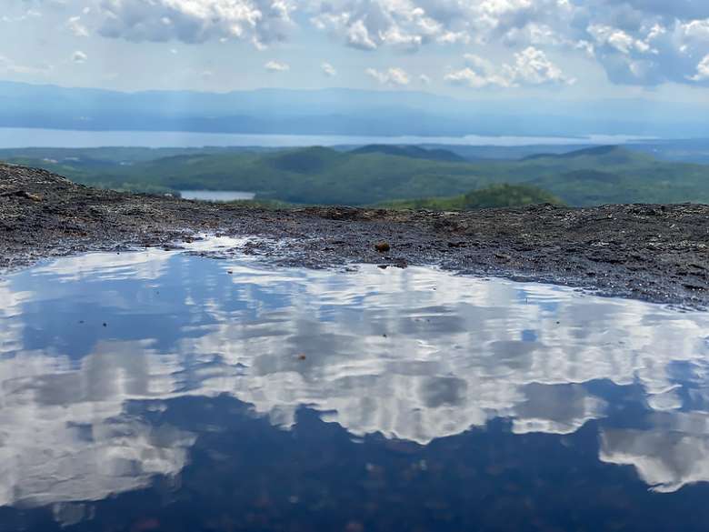
Wonder what you should expect on this hike? As you walk up the trail you’ll see numerous wildflowers decorating the path, enclosed by trees and the surrounding forest. There are a few different spots throughout the hike where the trail opens and provides sneak peeks before the main view at the summit. At these openings, you’ll see beautiful glimpses of mountains such as Whiteface, other Adk high peaks, and surrounding lakes. But, when you finally reach the summit and approach the fire tower, that is where the hike will take your breath away. The summit itself overlooks many of the ADK high peaks included in the “46er” challenge, as well as views of Lake Champlain and much of Vermont. The fire tower, which is open during summer months, provides the most memorable view of the hike and allows visitors to see a unique perspective of the northern part of the Lake Champlain Valley, Vermont, and the Plattsburg, NY, area!
CAUTION:
-If you or fellow hikers struggle with stairs, this hike may not be the best choice for you.
-This hike is challenging in the beginning but eventually becomes a more moderate trek with an extraordinary payoff; perfect for a moderately experienced hiker!
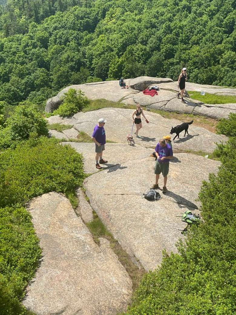
-Due to the worthwhile views this hike provides, the trail can at times be heavily trafficked. Consider taking this hike at a less busy time, around sunrise. The distance is perfect for an early morning hike and there is no better way to take in the view than with the orange, red, and pink hues of the sun meeting the morning.
DIRECTIONS:
-The drive from Lake George, NY to Poke-O-Moonshine can be as short as 1hr and 15 mins, or as long as 2hrs depending on the route you decide to take. We suggest taking the shorter route which consists mostly of driving on I-87 N, “The Northway”.
-First: Begin at the heart of Lake George, NY. Head west towards U.S. 9 N and after about ¾ of a mile, turn right at the first cross street onto U.S. 9 N.
-Next: Take the exit toward I 87 N and merge onto NY-912Q
-Then: Use the right lane to merge onto I-87 N via the ramp to Montreal and stay on I-87 N for about 80 miles until you reach the Chesterfield exit (33). Take exit 33 from I-87 N.
-Finally: Drive about 2.7 miles to U.S. 9 S and take a right toward U.S. 9 S. Turn right at the 1st cross street onto U.S. 9 S and in 2.6 miles your destination will be on the right!
References
-History from the files you sent
-https://www.adirondackalmanack.com/2020/09/whats-in-a-name-poke-o-moonshine-mountain.html (I looked here to find some info on the name because I found it to be so intriguing)