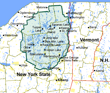
Adirondack Region Map -- The Blue Line
Discover New York State's Adirondack Park - which is a park like none other. Consisting of six-million-acres, hundreds of mountains (including 46 high peaks), over 3,000 lakes and ponds and nearly 30,000 miles of rivers and streams, this isn't a place you can explore in one day. The Adirondack Park is a unique patchwork of public and private lands, where communities live alongside "Forever Wild" areas and state-designated recreational lands. The Adirondacks include all or part of a dozen Upstate NY counties inside the 'Blue Line' that forms the border of the Adirondack Park. Learn more about how the Park came to be, and browse the maps below to discover the communities within this vast and beautiful region.
Click on one of the counties below to learn more:
- Clinton County
- Essex County
- Franklin County
- Fulton County
- Hamilton County
- Herkimer County
- Lewis County
- Oneida County
- Saratoga County
- St. Lawrence County
- Warren County
- Washington County
« Back to Northeast Region Map